
MCP-OSM: MCP용 OpenStreetMap 통합
이 패키지는 MCP에 OpenStreetMap 통합을 제공하여 사용자가 MCP 인터페이스를 통해 지도 데이터를 쿼리하고 시각화할 수 있도록 합니다.
특징
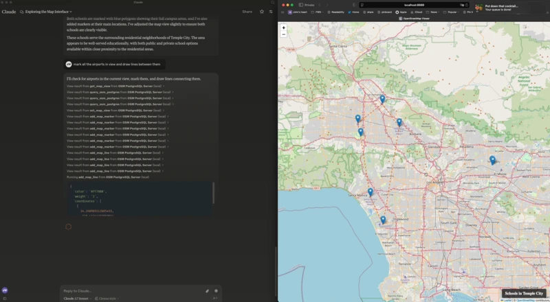
Leaflet과 OpenStreetMap을 사용한 웹 기반 지도 뷰어
SSE(Server-Sent Events)를 통한 서버-클라이언트 통신
지도 제어를 위한 MCP 도구(마커, 폴리곤 추가, 뷰 설정, 뷰 가져오기)
OpenStreetMap 데이터를 위한 PostgreSQL/PostGIS 쿼리 인터페이스
Related MCP server: OSP Marketing Tools MCP Server
설치
이것은 내 claude_desktop_config.json 입니다:
지엑스피1
MCP 서버가 시작되면 맵 인터페이스가 있는 http://localhost:8889/ 에서 웹 서버도 시작됩니다.
환경 변수
다음 환경 변수를 사용하여 MCP를 구성할 수 있습니다.
FLASK_HOST- Flask 서버의 호스트(기본값: 127.0.0.1)FLASK_PORT- Flask 서버의 포트(기본값: 8889)PGHOST- PostgreSQL 호스트(기본값: localhost)PGPORT- PostgreSQL 포트(기본값: 5432)PGDB- PostgreSQL 데이터베이스 이름(기본값: osm)PGUSER- PostgreSQL 사용자 이름(기본값: postgres)PGPASSWORD- PostgreSQL 비밀번호(기본값: postgres)
MCP 도구
사용 가능한 MCP 도구는 다음과 같습니다.
get_map_view- 현재 맵 뷰 가져오기set_map_view- 맵 뷰를 특정 좌표 또는 경계로 설정합니다.set_map_title- 지도 오른쪽 하단에 표시되는 제목을 설정합니다.add_map_marker- 특정 좌표에 마커 추가add_map_line- 좌표 집합으로 정의된 선을 추가합니다.add_map_polygon- 좌표 집합으로 정의된 다각형을 추가합니다.query_osm_postgres- OpenStreetMap 데이터베이스에 대해 SQL 쿼리를 실행합니다.