
MCP-OSM: MCP 向け OpenStreetMap 統合
このパッケージは、MCP 用の OpenStreetMap 統合を提供し、ユーザーが MCP インターフェースを通じてマップ データを照会および視覚化できるようにします。
特徴
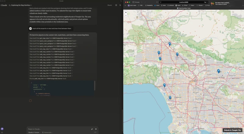
LeafletとOpenStreetMapを使用したWebベースの地図ビューア
サーバー送信イベント (SSE) によるサーバーとクライアント間の通信
マップ制御用の MCP ツール (マーカー、ポリゴンの追加、ビューの設定、ビューの取得)
OpenStreetMapデータ用のPostgreSQL/PostGISクエリインターフェース
Related MCP server: OSP Marketing Tools MCP Server
インストール
これは私のclaude_desktop_config.jsonです:
MCP サーバーが起動すると、マップ インターフェイスを持つhttp://localhost:8889/の Web サーバーも起動します。
環境変数
MCP を構成するには、次の環境変数を使用できます。
FLASK_HOST- Flaskサーバーのホスト(デフォルト: 127.0.0.1)FLASK_PORT- Flaskサーバーのポート(デフォルト: 8889)PGHOST- PostgreSQLホスト(デフォルト: localhost)PGPORT- PostgreSQLポート(デフォルト: 5432)PGDB- PostgreSQLデータベース名(デフォルト: osm)PGUSER- PostgreSQLユーザー名(デフォルト: postgres)PGPASSWORD- PostgreSQLパスワード(デフォルト: postgres)
MCPツール
次の MCP ツールが利用可能です。
get_map_view- 現在のマップビューを取得するset_map_view- マップビューを特定の座標または境界に設定するset_map_title- マップの右下に表示されるタイトルを設定しますadd_map_marker- 特定の座標にマーカーを追加するadd_map_line- 座標セットで定義された線を追加するadd_map_polygon- 座標セットで定義されたポリゴンを追加するquery_osm_postgres- OpenStreetMapデータベースに対してSQLクエリを実行する