Servidor MCP de Geoapify
Convierte direcciones en coordenadas GPS para mapeo y, opcionalmente, crea una imagen de esas coordenadas usando el servidor Geoapify.
Instalación
Necesitará obtener una clave API de Geoapify y configurarla como una variable de entorno llamada GEO_APIKEY .
Su claude_desktop_config.json se verá así después:
"MCP Map Demo": {
"command": "uv",
"args": [
"--directory",
"/PATH/TO/THIS/REPO",
"run",
"--with",
"fastmcp",
"--with",
"requests",
"--with",
"folio",
"--with",
"selenium",
"--with",
"pillow",
"fastmcp",
"run",
"/PATH/TO/THIS/REPO/server.py"
],
"env": {
"GEO_APIKEY": "YOURAPIKEY"
}
}
Notarás que incluimos todas las dependencias en nuestros args .
Related MCP server: Google Maps MCP Server
Herramientas
get_gps_coordinates
Se utiliza para obtener coordenadas GPS de la API para crear GEOJSON, etc.
create_map_from_geojson
Crea una imagen de mapa y muéstrala. (Mostrar solo funciona en MacOS por ahora).
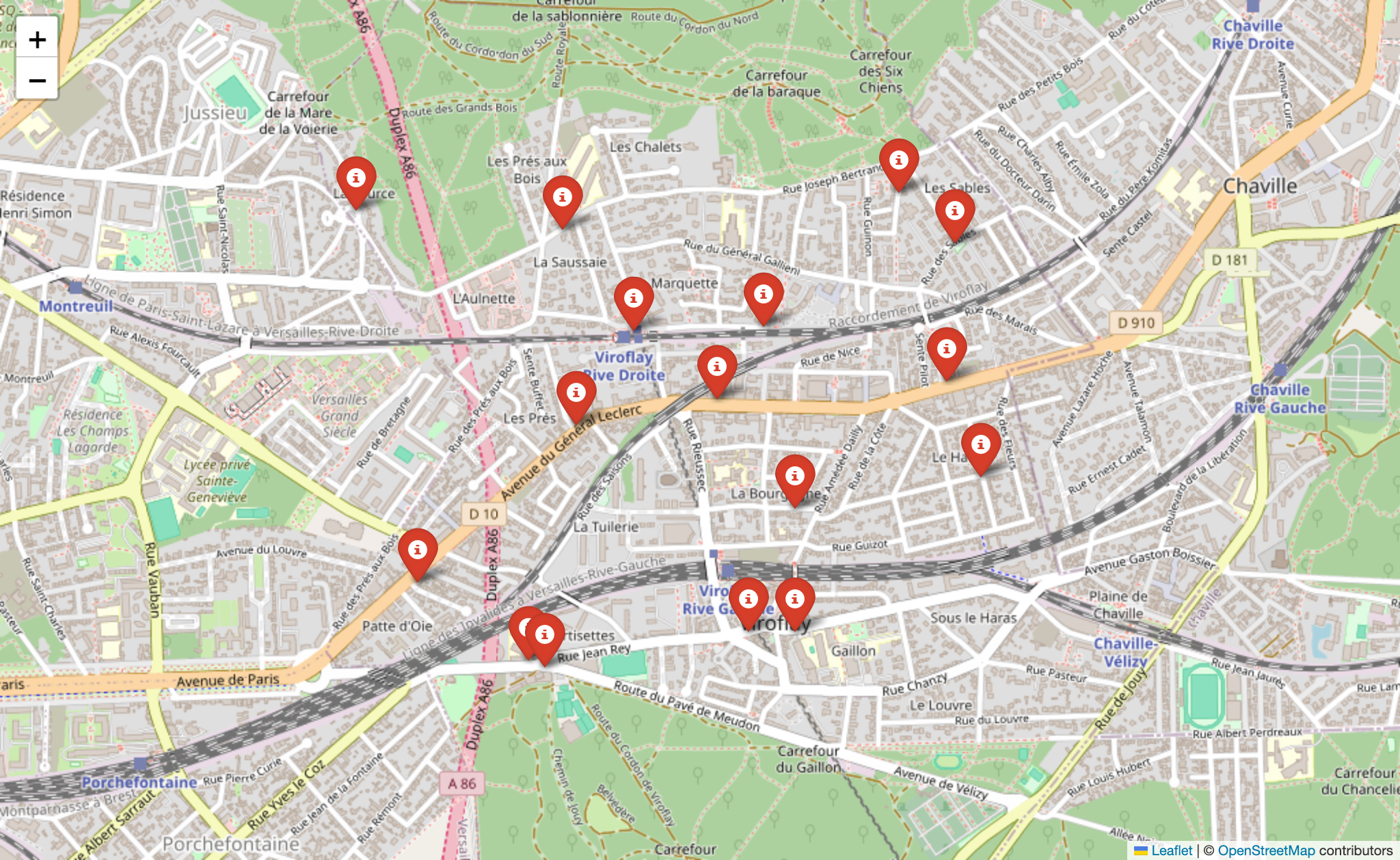
Ejemplo de uso
Obtener coordenadas GPS
can you create a geojson of the following locations including their gps coordinates: 179 avenue du Général Leclerc, côté Rive Gauche
158 avenue du Général Leclerc, côté Rive Droite à l'angle de la rue Jules Herbron
112 avenue du Général Leclerc, côté Rive Droite
34 avenue du Général Leclerc, côté Rive Droite
En face du 57 rue Gaston Boissier, à côté de la borne
Route du Pavé de Meudon - à côté du chêne de la Vierge
6 avenue de Versailles (près du centre aquatique des Bertisettes)
3 places sur parking de la rue Costes et Bellonte
Rue Joseph Chaleil
18 rue des Sables – à côté de la crèche
25 sente de la Procession
33 rue Joseph Bertrand
Place Saint Paul
Place de la bataille de Stalingrad
Placette croisement avenue Pierre Grenier / avenue Robert Hardouin
107 avenue Gaston Boissier (en face de la caserne des pompiers)
Resultado: Archivo JSON adjunto
Devuelve un archivo GeoJSON.
Crear una imagen de mapa
can you create a map from my attached geojson file?
Archivo JSON adjunto
Resultado:
LICENCIA
Instituto Tecnológico de Massachusetts (MIT)
