A
licenseA
qualityD
maintenanceProvides access to Google Maps API functionality including places search, geocoding, directions, distance matrix, elevation data, and static map generation through the MCP interface.
8
14 npm
1
MIT

该软件包为 MCP 提供 OpenStreetMap 集成,允许用户通过 MCP 界面查询和可视化地图数据。
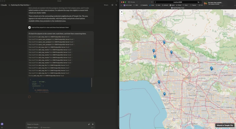
使用 Leaflet 和 OpenStreetMap 的基于 Web 的地图查看器
通过服务器发送事件 (SSE) 进行服务器到客户端通信
用于地图控制的 MCP 工具(添加标记、多边形、设置视图、获取视图)
OpenStreetMap 数据的 PostgreSQL/PostGIS 查询接口
Related MCP server: Google Maps Platform MCP Server
这是我的claude_desktop_config.json :
{
  "mcpServers": {
    "OSM PostgreSQL Server": {
      "command": "/Users/wiseman/.local/bin/uv",
      "args": [
        "run",
        "--env-file",
        ".env",
        "--with",
        "mcp[cli]",
        "--with",
        "psycopg2",
        "--with-editable",
        "/Users/wiseman/src/mcp-osm",
        "--directory",
        "/Users/wiseman/src/mcp-osm",
        "mcp",
        "run",
        "mcp.py"
      ]
    }
  }
}
当 MCP 服务器启动时,它还会在http://localhost:8889/启动一个具有地图界面的 Web 服务器。
以下环境变量可用于配置 MCP:
FLASK_HOST - Flask 服务器的主机(默认值:127.0.0.1)
FLASK_PORT - Flask 服务器的端口(默认值:8889)
PGHOST - PostgreSQL 主机(默认:localhost)
PGPORT - PostgreSQL 端口(默认值:5432)
PGDB -PostgreSQL 数据库名称(默认:osm)
PGUSER - PostgreSQL 用户名(默认值:postgres)
PGPASSWORD - PostgreSQL 密码(默认:postgres)
以下 MCP 工具可用:
get_map_view - 获取当前地图视图
set_map_view - 将地图视图设置为特定坐标或边界
set_map_title - 设置地图右下角显示的标题
add_map_marker - 在特定坐标处添加标记
add_map_line - 添加由一组坐标定义的线
add_map_polygon - 添加由一组坐标定义的多边形
query_osm_postgres - 对 OpenStreetMap 数据库执行 SQL 查询
This server cannot be deployed
OpenTripMap MCP — wraps the OpenTripMap Places API (dev.opentripmap.org)
Nominatim MCP — wraps OpenStreetMap Nominatim geocoding API (free, no auth)
OpenStreetMap Overpass MCP — programmatic queries against the OSM database
MCP registry & directory: search, find & install 31k+ MCP servers & tools. Catalog and marketplace.