
OpenStreetMap(OSM)MCP服务器
OpenStreetMap MCP 服务器实现,通过基于位置的服务和地理空间数据增强 LLM 功能。
演示
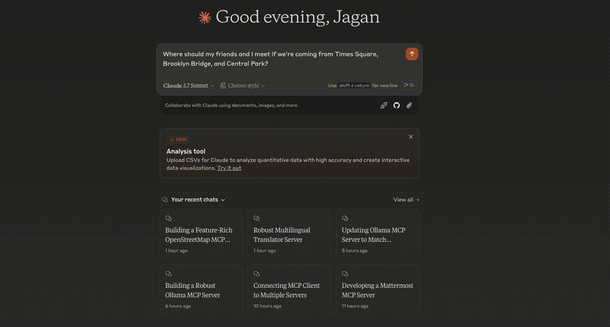
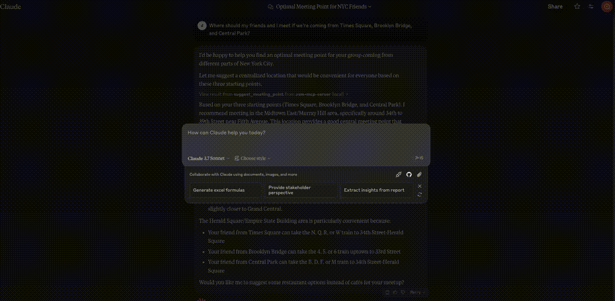
会合点优化
邻域分析
停车位搜索
Related MCP server: Travel Planner MCP Server
特征
该服务器为 LLM 提供与 OpenStreetMap 数据交互的工具,使基于位置的应用程序能够:
将地址和地名地理编码为坐标
将地理编码坐标反向转换为地址
查找附近的兴趣点
获取位置之间的路线指引
在边界框内按类别搜索地点
为多人推荐最佳会面地点
探索区域并获取全面的位置信息
查找某个地点附近的学校和教育机构
分析家和工作地点之间的通勤选择
定位带有连接器和电源滤波的电动汽车充电站
执行房地产社区宜居性分析
查找停车设施的可用性和费用信息
成分
资源
服务器实现基于位置的资源:
location://place/{query}:按名称或地址获取地点信息location://map/{style}/{z}/{x}/{y}:获取指定坐标处的样式地图图块
工具
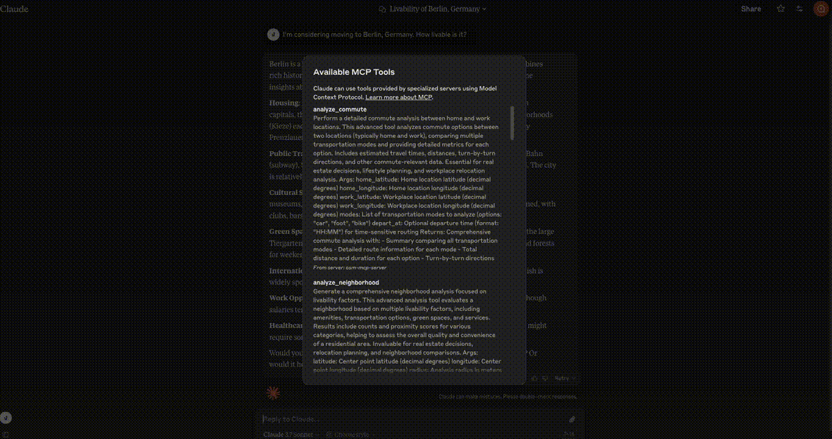
该服务器实现了几个地理空间工具:
geocode_address:将文本转换为地理坐标reverse_geocode:将坐标转换为人类可读的地址find_nearby_places:发现某个地点附近的兴趣点get_route_directions:获取位置之间的逐向导航search_category:查找某个区域内特定类别的地点suggest_meeting_point:为多人寻找最佳会面地点explore_area:获取有关社区的综合数据find_schools_nearby:查找特定位置附近的教育机构analyze_commute:比较家和工作地点之间的交通选择find_ev_charging_stations:通过筛选定位电动汽车充电基础设施analyze_neighborhood:评估房地产社区的宜居性find_parking_facilities:查找目的地附近的停车选项
用例
房地产决策
法学硕士可以帮助用户评估潜在的购房社区:
本地测试
运行服务器
要在本地运行服务器:
以开发模式安装包:
pip install -e .启动服务器:
osm-mcp-server服务器将启动并监听标准输入/输出上的 MCP 请求。
使用示例客户端进行测试
该存储库在examples/目录中包含两个示例客户端:
基本客户端示例
client.py演示了 OSM MCP 服务器的基本用法:
python examples/client.py这将:
连接到本地运行的服务器
获取有关旧金山的信息
搜索该地区的餐馆
通过进度跟踪检索综合地图数据
LLM 集成示例
llm_client.py提供了一个专为 LLM 集成设计的帮助类:
python examples/llm_client.py此示例展示了法学硕士 (LLM) 如何使用位置助手来执行以下操作:
从文本查询中获取位置信息
查找附近的兴趣点
获取地点之间的路线
寻找最佳会面地点
探索社区
编写自己的客户端
要创建您自己的客户端:
导入MCP客户端:
from mcp.client import Client使用您的服务器 URL 初始化客户端:
client = Client("http://localhost:8000")调用工具或访问资源:
# Example: Geocode an address
results = await client.invoke_tool("geocode_address", {"address": "New York City"})
配置
安装
克劳德桌面
在 MacOS 上: ~/Library/Application\ Support/Claude/claude_desktop_config.json在 Windows 上: %APPDATA%/Claude/claude_desktop_config.json
"mcpServers": {
  "osm-mcp-server": {
    "command": "uv",
    "args": [
      "--directory",
      "/path/to/osm-mcp-server",
      "run",
      "osm-mcp-server"
    ]
  }
}
"mcpServers": {
"osm-mcp-server": {
"command": "uvx",
"args": [
"osm-mcp-server"
]
}
}发展
构建和发布
准备分发包:
同步依赖项并更新锁文件:
uv sync构建软件包分发版:
uv build这将在dist/目录中创建源和轮子分布。
发布到 PyPI:
uv publish注意:您需要通过环境变量或命令标志设置 PyPI 凭据。
调试
由于 MCP 服务器通过 stdio 运行,调试起来可能比较困难。为了获得最佳调试体验,我们强烈建议使用MCP Inspector 。
您可以使用以下命令通过npm启动 MCP Inspector:
npx @modelcontextprotocol/inspector uv --directory /path/to/osm-mcp-server run osm-mcp-server启动后,检查器将显示一个 URL,您可以在浏览器中访问该 URL 以开始调试。
API 使用示例
以下是如何使用 Python 代码中的关键 API 端点的简单示例:
import asyncio
from mcp.client import Client

async def main():
    client = Client("http://localhost:8000")

    # Geocode an address
    results = await client.invoke_tool("geocode_address", {"address": "Empire State Building"})
    print(f"Found location: {results[0]['display_name']}")

    # Get coordinates
    lat = float(results[0]['lat'])
    lon = float(results[0]['lon'])

    # Find nearby coffee shops
    nearby = await client.invoke_tool(
        "find_nearby_places",
        {
            "latitude": lat,
            "longitude": lon,
            "radius": 500,
            "categories": ["amenity"],
            "limit": 5
        }
    )

    # Print results
    print(f"Found {nearby['total_count']} nearby places")
    for category, subcategories in nearby["categories"].items():
        for subcategory, places in subcategories.items():
            print(f"  - {subcategory}: {len(places)} places")

if __name__ == "__main__":
    asyncio.run(main())