
The OpenStreetMap MCP Server enhances LLM capabilities by providing location-based services and geospatial data processing for applications. With this server, you can:
Geocode addresses: Convert text descriptions into geographic coordinates with metadata
Reverse geocode: Transform coordinates into human-readable addresses
Find nearby places: Discover points of interest around specific locations
Get route directions: Calculate turn-by-turn navigation for walking, biking, or driving
Search by category: Find specific types of places within defined areas
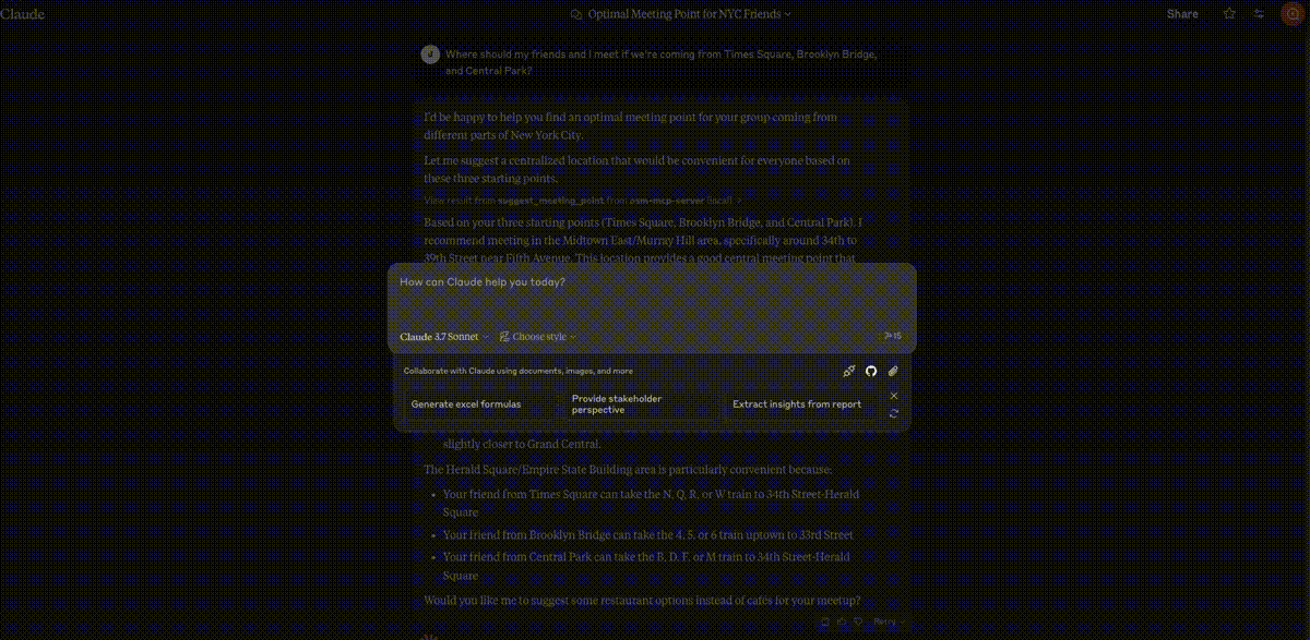
Suggest meeting points: Determine optimal meeting locations for multiple people
Explore areas: Analyze neighborhoods for amenities and points of interest
Find schools: Locate educational institutions with filters
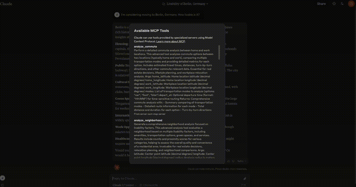
Analyze commutes: Evaluate transportation options between locations
Find EV charging stations: Locate charging infrastructure with connector and power filters
Assess neighborhood livability: Evaluate quality of life factors
Find parking facilities: Locate parking options with capacity and fee details
Supports debugging via the MCP Inspector which can be launched using npm to monitor and troubleshoot the MCP server communications.
Provides geospatial tools for interacting with OpenStreetMap data, including geocoding, reverse geocoding, finding nearby points of interest, route directions, location search by category, meeting point optimization, area exploration, and neighborhood analysis.
Enables publishing and distribution of the MCP server package through PyPI, allowing users to easily install the server.
Click on "Install Server".
Wait a few minutes for the server to deploy. Once ready, it will show a "Started" state.
In the chat, type
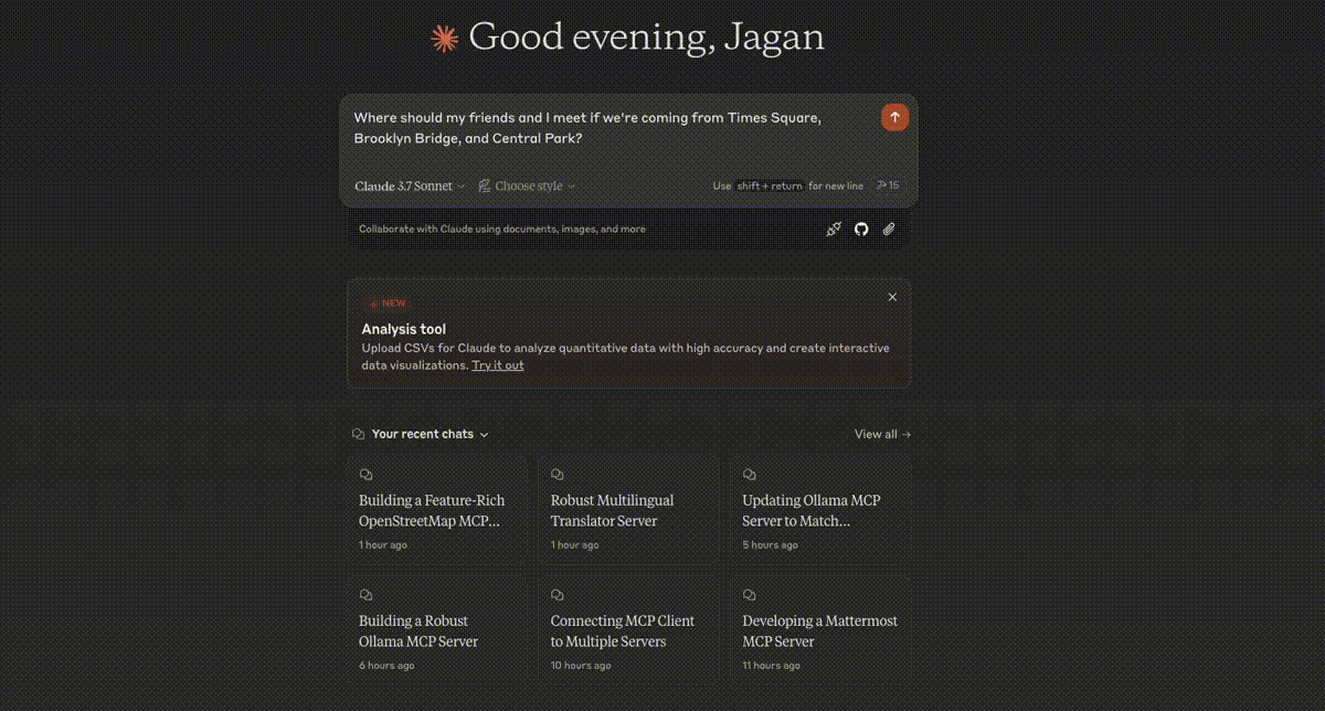
@followed by the MCP server name and your instructions, e.g., "@OpenStreetMap MCP Serverfind the best meeting point for friends coming from downtown, midtown, and uptown"
That's it! The server will respond to your query, and you can continue using it as needed.
Here is a step-by-step guide with screenshots.
OpenStreetMap (OSM) MCP Server
An OpenStreetMap MCP server implementation that enhances LLM capabilities with location-based services and geospatial data.
Demo
Meeting Point Optimization
Neighborhood Analysis
Parking Search
Related MCP server: Travel Planner MCP Server
Installation
In MCP Hosts like Claude Desktop, Cursor, Windsurf, etc.
osm-mcp-server: The main server, available for public use."mcpServers": { "osm-mcp-server": { "command": "uvx", "args": [ "osm-mcp-server" ] } }
Features
This server provides LLMs with tools to interact with OpenStreetMap data, enabling location-based applications to:
Geocode addresses and place names to coordinates
Reverse geocode coordinates to addresses
Find nearby points of interest
Get route directions between locations
Search for places by category within a bounding box
Suggest optimal meeting points for multiple people
Explore areas and get comprehensive location information
Find schools and educational institutions near a location
Analyze commute options between home and work
Locate EV charging stations with connector and power filtering
Perform neighborhood livability analysis for real estate
Find parking facilities with availability and fee information
Components
Resources
The server implements location-based resources:
location://place/{query}: Get information about places by name or addresslocation://map/{style}/{z}/{x}/{y}: Get styled map tiles at specified coordinates
Tools
The server implements several geospatial tools:
geocode_address: Convert text to geographic coordinatesreverse_geocode: Convert coordinates to human-readable addressesfind_nearby_places: Discover points of interest near a locationget_route_directions: Get turn-by-turn directions between locationssearch_category: Find places of specific categories in an areasuggest_meeting_point: Find optimal meeting spots for multiple peopleexplore_area: Get comprehensive data about a neighborhoodfind_schools_nearby: Locate educational institutions near a specific locationanalyze_commute: Compare transportation options between home and workfind_ev_charging_stations: Locate EV charging infrastructure with filteringanalyze_neighborhood: Evaluate neighborhood livability for real estatefind_parking_facilities: Locate parking options near a destination
Local Testing
Running the Server
To run the server locally:
Install the package in development mode:
Start the server:
The server will start and listen for MCP requests on the standard input/output.
Testing with Example Clients
The repository includes two example clients in the examples/ directory:
Basic Client Example
client.py demonstrates basic usage of the OSM MCP server:
This will:
Connect to the locally running server
Get information about San Francisco
Search for restaurants in the area
Retrieve comprehensive map data with progress tracking
LLM Integration Example
llm_client.py provides a helper class designed for LLM integration:
This example shows how an LLM can use the Location Assistant to:
Get location information from text queries
Find nearby points of interest
Get directions between locations
Find optimal meeting points
Explore neighborhoods
Writing Your Own Client
To create your own client:
Import the MCP client:
Initialize the client with your server URL:
Invoke tools or access resources:
Claude Desktop config for local server
On MacOS: ~/Library/Application\ Support/Claude/claude_desktop_config.json
On Windows: %APPDATA%/Claude/claude_desktop_config.json
Development
Building and Publishing
To prepare the package for distribution:
Sync dependencies and update lockfile:
Build package distributions:
This will create source and wheel distributions in the dist/ directory.
Publish to PyPI:
Note: You'll need to set PyPI credentials via environment variables or command flags.
Debugging
Since MCP servers run over stdio, debugging can be challenging. For the best debugging experience, we strongly recommend using the MCP Inspector.
You can launch the MCP Inspector via npm with this command:
Upon launching, the Inspector will display a URL that you can access in your browser to begin debugging.